|
| *****SWAAG_ID***** | 836 |
| Date Entered | 18/09/2014 |
| Updated on | 20/09/2014 |
| Recorded by | Tim Laurie |
| Category | Geological Record |
| Record Type | Geological HER |
| Site Access | Public Access Land |
| Record Date | 31/08/2014 |
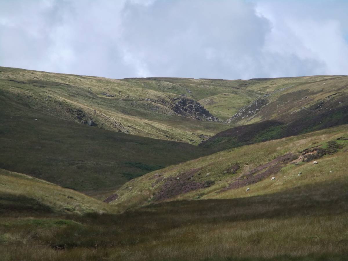
| Location | Little Sleddale. West Gill Head |
| Civil Parish | Muker |
| Brit. National Grid | NY 80688 99978 |
| Altitude | 675m |
| Geology | Namurian shales and sandstones. Thick beds of black shale with minor faulting. |
| Record Name | Little Sleddale. West Sike. Small faults infilled with white calcite in black shales |
| Record Description | Small oblique faults displacing horizontal nodular bands. The fault being infilled with white calcite and thus readily visible in black shales.
I thank John Russell for his Notes on Faults, Shales, Siltstones and Mudstones.
Thick beds of these soft dark rocks are present within the cyclic, alternating beds of limestone, thin coals and sandstone or gritstone strata which form the scenery of the Pennine Dales. These impervious shales and mudstones, being soft form spring lines above the more gentle concave slopes below the harder limestones and sandstones but are themselves rarely exposed except in the uppermost Gills where they can be prominent. |
| Dimensions | See photos. |
| Additional Notes | Geological Notes- thanks to John Russell:
A simple guide to faults-
1 Shortening of the crust gives reverse faults-compression.
2 Stretching gives normal faults tension..
Faulting in shale is a XXXXX because shale is an incompetant rock and faults run everywhere.
The rocks you mentioned are all very fine grained and to study them properly you need X ray diffraction techniques.
Mudstone is a mixture of clay minerals mica and quartz.There is no layering of minerals and no plasticity.
Shale shows distinct layers due to the alignment of clay minerals which are flat and platy-caused by the weight of the overlying rocks.Layers and laminations are described as fissile.
Shale is not plastic and crumbles easily and is described as brittle-it is impermeable.
Shale colour varies from grey to black depending on organics and iron content.
Shale and mudstone have particle size around 2 microns.Between 4-6 microns come the silts and siltstone.Very difficult to tell them apart.The silt particles are just visible to the naked eye.
|
| Image 1 ID | 5849 Click image to enlarge |
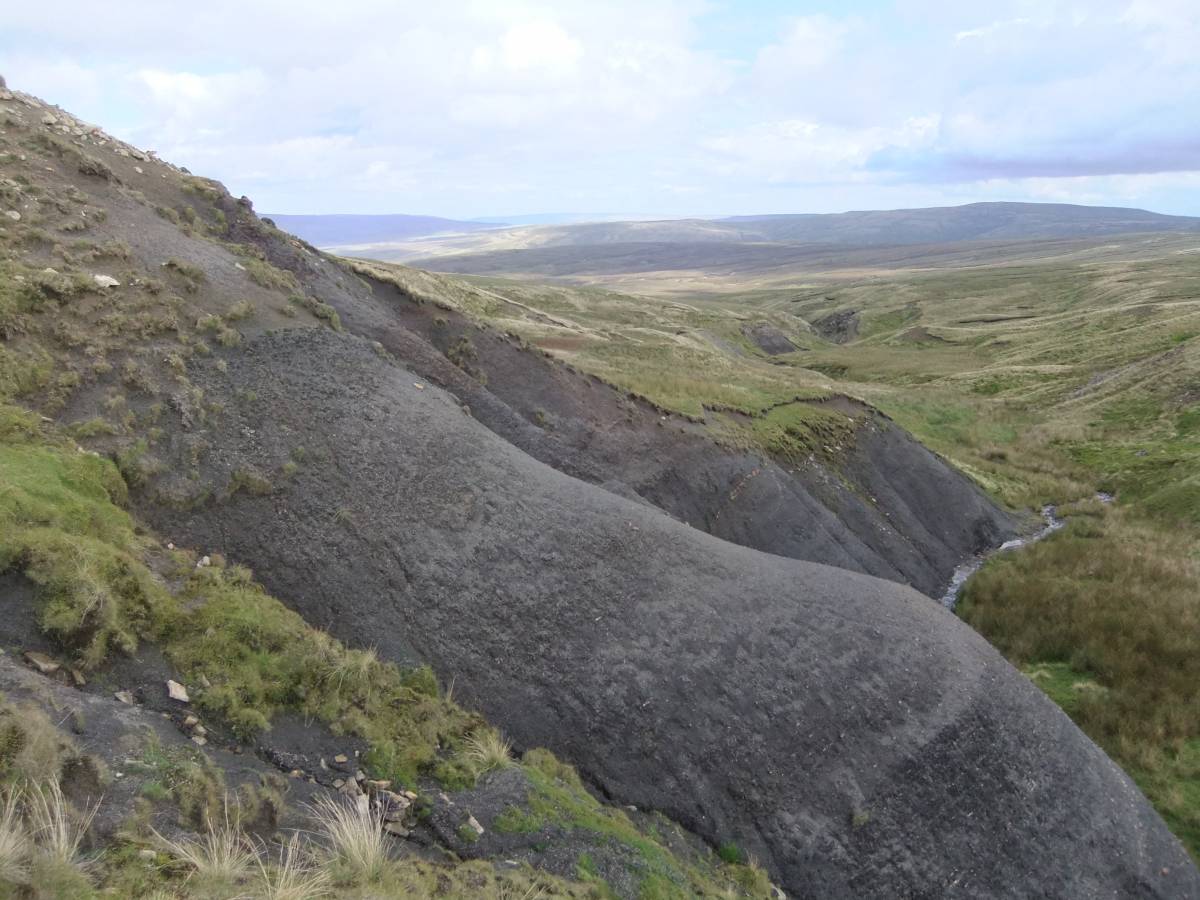
| Image 1 Description | Little Sleddale. Black shales exposed on the bank of West Gill Beck. | 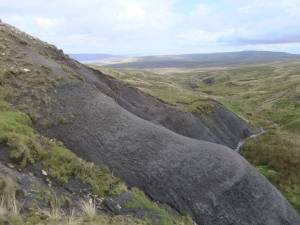 |
| Image 2 ID | 5850 Click image to enlarge |
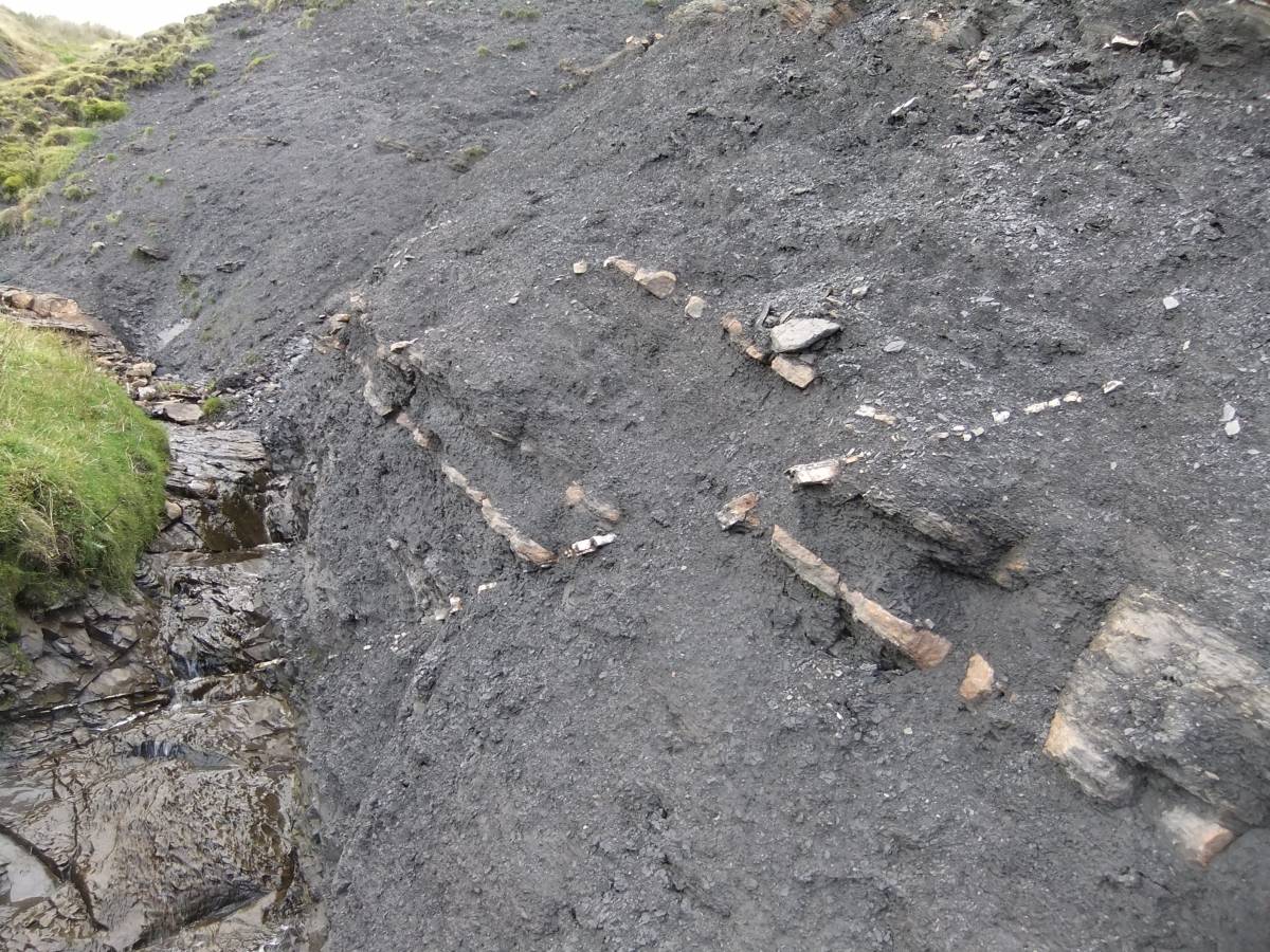
| Image 2 Description | Two parallel oblique faults displacing horizontal nodular bands in black shales above the bed of the stream. | 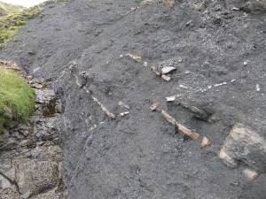 |
| Image 3 ID | 5851 Click image to enlarge |
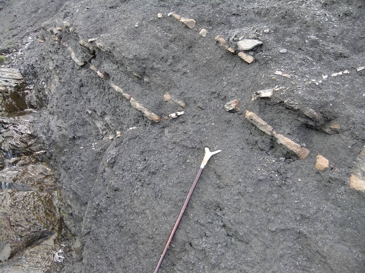
| Image 3 Description | The calcite infil to the faults continues through the bedrock of the stream underlying the shale. | 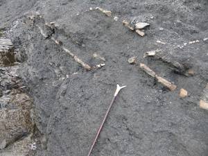 |
| Image 4 ID | 5852 Click image to enlarge |
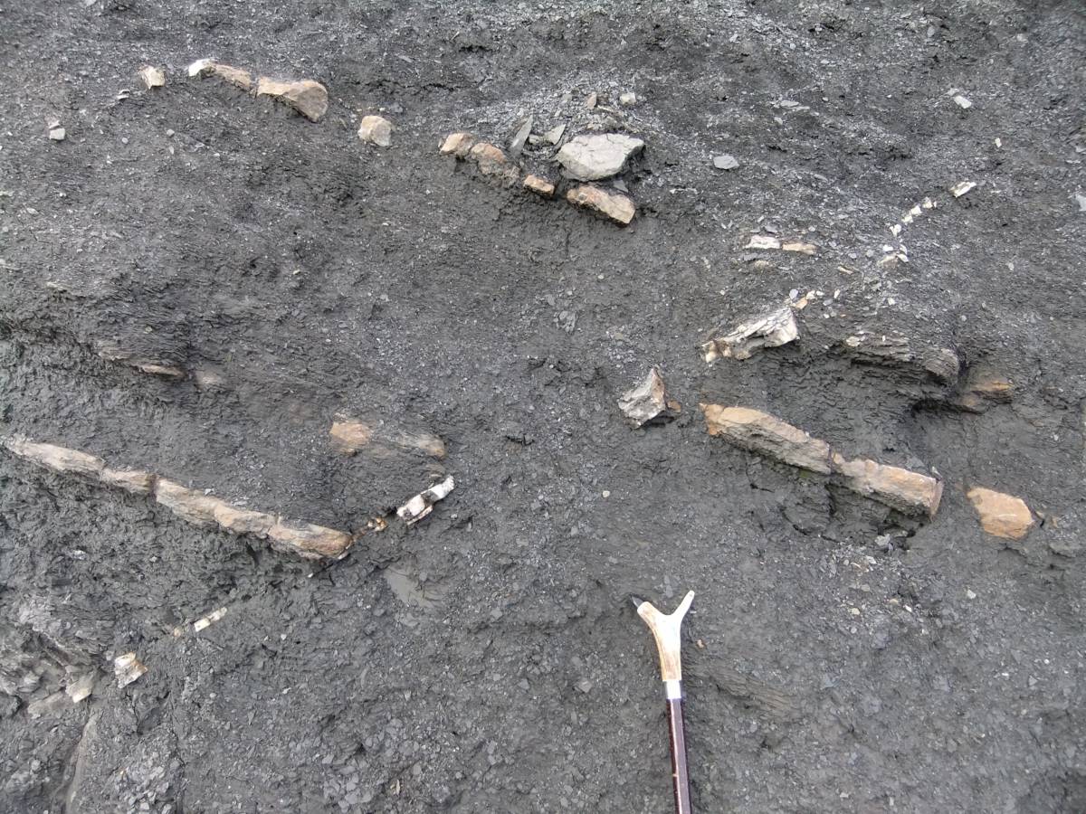
| Image 4 Description | Detail of the faults | 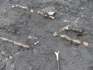 |
| Image 5 ID | 5854 Click image to enlarge |
| Image 5 Description | Detail of the faults |  |
| Image 6 ID | 5853 Click image to enlarge |
| Image 6 Description | West Gill seen from below. | 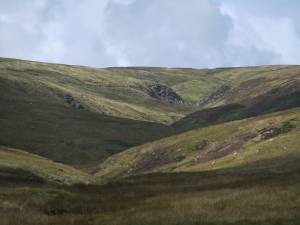 |